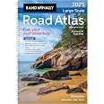
Rand McNally Road Atlas Large Scale 2025: United States, Canada, Mexico (Rand McNally Large Scale Road Atlas USA)


F**S
Extremely well detailed!
The Rand McNally Large Scale Road Atlas 2025 is a comprehensive and user-friendly resource for travelers, offering detailed maps and information for navigating the roads of the United States and Canada. Here’s a review highlighting its features, benefits, and considerations:FeaturesLarge Scale Maps: The atlas features large-scale maps that provide clear and detailed representations of highways, roads, and points of interest, making it easy to read and navigate.Spiral-Bound Design: The spiral binding allows the atlas to lay flat when open, making it convenient for use in the car or while planning trips.Folded Map Format: The atlas is designed in a folded map format, which is easy to handle and store, fitting well in glove compartments or travel bags.Updated Information: As a 2025 edition, it includes the latest road information, including new highways, changes in routes, and updated points of interest, ensuring that users have current data for their travels.Points of Interest: The atlas highlights various points of interest, including national parks, historical sites, and recreational areas, making it a great companion for road trips and exploration.Travel Tips and Resources: The atlas often includes travel tips, state facts, and other useful information that can enhance the travel experience.BenefitsUser-Friendly: The large print and clear layout make it easy for users of all ages to read and navigate, which is especially beneficial for long-distance travel.Durability: The spiral-bound design and quality paper make it more durable than traditional atlases, allowing it to withstand frequent use during trips.Comprehensive Coverage: With detailed maps of all U.S. states and Canadian provinces, it serves as a reliable resource for both local and long-distance travel.ConsiderationsDigital Alternatives: While the atlas is a great resource, some users may prefer digital navigation tools or apps for real-time updates and GPS functionality.Size: The large size of the atlas may make it less portable than smaller maps or atlases, so users should consider their storage options when traveling.ConclusionThe Rand McNally Large Scale Road Atlas 2025 is an excellent tool for anyone who enjoys road trips or needs a reliable map for navigating the highways and byways of North America. Its large-scale maps, user-friendly design, and updated information make it a valuable resource for travelers. While digital navigation tools are popular, this atlas provides a tangible and comprehensive alternative that can enhance the travel experience. Overall, it’s a highly recommended choice for those looking to explore the open road with confidence.
D**S
Excellent for the Apocalypse
When an EMP (Electro-magnetic-pulse) or massive solar flare burns out our GPS satellites only those who have a road atlas, and know how to use it, will be able to navigate the roads of this vast country. While the Gen z-er's and Gen Alpha's are wandering, confused and aimless without Google Maps to guide them, those who remember the old ways will be kings and queens in the land. Only they will be able to interpret the arcane knowledge hidden in the squiggly colored lines printed on something called "paper," in something called, "a book." Only they will be able to guide the young ones to sustenance- "The Piggly Wiggly is . . . that way!" Don't be a fool. Prepare for the apocalypse now. Buy this road atlas.
D**D
To my copilot...are we going north or south?
This has proven to be invaluable tool when my copilot struggles with her phone and we are on a 1500 mile trek. I did buy a compass as well to fix the are we going south or north problem when her phone gets wonky. It only takes one closed interstate entrance ramp with no warning to spin you into 2 hrs of middle of nowhere farm country which is no big deal unless you need to cover a certain distance to get to a campsite on time. Get my drift?
C**E
Can see the whole route of a trip
Bought so we could map out different routes for long trips. GPS is wonderful but you can’t see enough of the area your covering when traveling a long distance. Gives you the option of choosing when you can see an entire state or states at one time . Also the print is nice size.
J**B
Good, but not great.
Been a while since I've bought a map book, but overall it is pretty good, and it does seem they've learned some things from previous versions. For instance even though it's spiral bound, the holes go through the margins, instead of part of the map itself. Small things like that are helpful, as inevitably fate will somehow ensure those holes mess up your route in some way.I do however have a few critiques and suggestions for a future version.1. Laminated pages. It seems like decent quality paper, but if you have this available for easy access in a car, inevitably it will be close to a drink, food, open window, etc, and some liquid/sauce/grease will get onto it. I'd much rather have it easier to clean off, than permanently staining the map. Additionally, this will help reinforce the holes the spiral goes through.2. There is an overview of the entire US at the beginning of the book, showing the major cities and highways, and then each state is broken down into different pages, giving a very detailed of the streets. However there is no overview showing which page corresponds to which portion of the state, and since you need a map, you're likely not familiar with each state, making it more confusing. I think they should have a page at the start of each state section, giving a general overview of the state, with grid lines showing which portion of the state can be found on which page. The same could also be shown for adjoining states, making it easier to trace your route through each state.Again, it is overall good, just think it needs a few tweaks to make it great.
P**R
Old fashioned utility!
Yup. An old fashioned atlas. It’s nice to get the big picture that’s missing on GPS, Google maps, etc. I couldn’t figure out where our driving route from MN to MA was going to cross NY. Easy.And lots of just browsing over places you’ll probably never go…
N**Y
New and Improved Road Atlas
Although I use GPS when traveling to unfamiliar locations, I still like to have hard copy maps on hand to provide me with a backup method of navigation and, more importantly, trip planning. Call me "old school" (well, I AM old), but I grew up using hard copy maps and I feel very comfortable using them. Highly recommended.
K**R
We use this atlas regularly!
Some other reviews seem to have a problem with the large size -- the large size is exactly why we bought this! Its great to be able to see more detail.
Trustpilot
3 days ago
2 months ago

![National Geographic Road Atlas 2025: Adventure Edition [United States, Canada, Mexico]](https://images-na.ssl-images-amazon.com/images/I/81rRihqWqgL._AC_UL116_SR116,116_.jpg)